Friday, September 5, 2014

SHR: post-trip, drive home

Post-trip:
Becky decided that she wanted to take the least-direct route home in order to stretch the vacation. We left Lee Vining at 1:30 on Thursday, 9/4 and started our migration north by way of Monitor Pass (so winding and fun to drive!), Lake Tahoe (so blue and populated by the wealthy!) and finally Truckee (so cute and straight out of Sunset magazine!). We purchased some personal hygiene products (since you can’t leave those in the car due to bears), got a last minute room at the Hotel Truckee Tahoe and took much-needed long, hot showers. The hotel was conveniently located across the street from the Fifty Fifty brewing company so we walked over, had tasty dinners, two beers each (great porter and a citrus-y ale!) and made it back to the hotel in time to catch the last quarter of the Seahawks game.

The next morning, we found a great coffee shop in downtown Truckee where we picked up a couple of delicious pastries and large coffees. We wandered the old-timey main street peering in the windows of the numerous cutesy shops and restaurants before getting back on the road at 9:30. Our next stop was Lassen National Park.

Our goal at Lassen was to visit the geothermal area known as Bumpass Hell. It’s the largest geothermal area west of Yellowstone! Along the way we discovered there is a  trail to the summit of Lassen Peak that is only 5 miles round trip and 2000 feet. We decided to tick another Cascade volcano off the list, but were dismayed to learn the trail is closed for restoration. Boo. We still got to hike in the 1.5 miles to Bumpass Hell to see the boiling mud pots, steaming fumeroles and yellow crystals of sufur dioxide that formed on the ground. Definitely worth a stop if you’re ever at Lassen.

Continued west to catch up to I-5 and stopped in Ashland for dinner at the Standing Stone Brewery. Only tried one beer here, a citrus-y ale, but it was very tasty and refreshing. We drove another 10 miles up to Medford where we knew we’d find cheaper accommodations, checked in to a hotel and crashed.

The next day we drove up to Eugene so we could wander the campus and Pete could reminisce about his days there. It was game day against the Michigan State Spartans and the whole city was crawling with people decked out in their finest Ducks gear. We looked into getting last minute tickets, but couldn’t stomach paying $109 each so we just got lunch at Burrito Boy, one of Pete’s favorite haunts from college, and pounded out the last five hours of driving back to Seattle. The cherry on the trip was that we got home in time to watch the Ducks trounce the Spartans on TV. A fine ending to a fabulous trip.


Thursday, September 4, 2014

SHR Day 10: Lyell Canyon

Day 10: Lyell Canyon

We had 12 downhill/flat trail miles to get back to the car and figured it would take us about five hours so we were off by 7am. Becky’s feet had de-swelled overnight enough to get her blistered toe into her shoe with relative ease, but she knew that as soon as the heat came up, her feet would puff out again and pinch her poor abused toes so we walked as fast as we could.

Becky’s goal was to get to the car in time to get to the Whoa Nellie Deli in Lee Vining by lunch. Mission accomplished. We walked into the Dog Lake Parking lot a few minutes before noon, located our car that Andy and Mica had deposited there one week prior, disrobed and shoved our filthy trail clothes into a garbage bag and headed down the Tioga Pass Road to Lee Vining where we ordered a cheeseburger and fries and lobster taquitos from the deli. We’re not entirely sure where the “lobster” came in to those taquitos, it was more of a refried bean consistency with a slightly lobster-y flavor, but it tasted good and more importantly, came with a pile of fresh vegetables so we ate every last bite.


Wednesday, September 3, 2014

SHR Day 9: Donahue Pass

Day 9: Donahue Pass

The wind howled that night and the flapping of the tent fly kept Becky awake for four hours. During this time she decided that damaged appendages + no sleep = take the obvious route home. It was really tough to abandon the SHR as we knew the next section would offer some amazing, rarely visited terrain, but Becky was not sure she could make it through another 11 miles of rough travel safely.

We struck off overland to intersect the JMT a couple miles north. It was both strange and comforting to be back on that highway. We climbed up to Donohue Pass, greeting the throngs of southbound JMT travelers along the way. When we hiked the JMT in 2010 we didn’t notice that many people on the trail, but that’s because we were all traveling north to south. When you’re swimming upstream, it really becomes clear just how popular this trail is.

We stopped at a tarn on the other side of Donohue Pass above Lyell Canyon and Becky inspected her feet. She discovered a blister had formed on her right pinky toe that encompassed the whole end of her toe and swelled it to half again its normal size. This caused great discomfort in her hiking shoe and we decided to put down camp after another mile of limping down the trail.

We enjoyed our last night on the trail - reading, napping, eating and taking in the last of the high-alpine views. We knew the next day’s return to the car meant much-anticipated clean clothes and cheeseburgers, but we were sad to be leaving the peace and tranquility of the high Sierra.


Tuesday, September 2, 2014

SHR Day 8: Minarets, Ritter & Banner

Day 8: Minarets, Ritter & Banner

We got up in the dark and as the morning light crept into the sky we were serenaded by a coyote from somewhere very near by. Kinda cool. Kinda creepy.

The steep climb up to Nancy Pass was the familiar blend of grassy steps, a dirty scree path and blocky talus with a little bit of bushwhacking thrown in for good measure. The geology of this region was very different from the southern high Sierra and we were presented with talus of a wider variety of shapes and sizes - not as many car-sized boulders, but lots of unstable rocks from microwave to grapefruit to pea size. It required a lot of concentration to navigate, but the colors of the different rocks were amazing and provided good distraction.

On the opposite side of Nancy Pass, we dropped down some steep talus, contoured around several wooded benches and wandered through green meadowlands before climbing up to Minaret Lake. There is a maintained trail that goes from the JMT straight to Minaret Lake and we’d be lying if we said we didn’t kind of wish we’d just opted to take it from the get go. Looking up we could start to see the steep and craggy towers of the Minarets above.

After contouring around the lake you come to an imposing headwall that forms a dam for Cecile Lake above. We climbed up to it and despite all the footprints indicating that it was the correct path, were stumped by how to mount what Roper nonchalantly describes as a short “third class slot”. Without a pack on, the climbing would be fine, but with a pack on it was decidedly more difficult, particularly for those of a shorter stature. As Becky fretted and fumed about being sand-bagged by stupid Steve Roper (Pete still maintains it was really only third class and not all that bad), a group of eight Russian trail angels from Florida (no kidding) with a rope appeared and graciously offered to climb up the 20 foot section and then haul our packs on their rope. They’d backpacked this section many years ago and knew a haul line for their particularly large backpacks would be handy. Becky badly wanted to find a different way around so as to navigate the section independently, but there was no other obvious path so we thanked them profusely and accepted their offer. Had our fellow backpackers not arrived, we would’ve figured something out, either climbing with packs or pulling the perlon guylines from the tent to make a haul line, but accepting the assistance was a nice time-saver.

Soon we were standing at the top, packs in hand, once again thanking the Russians for their generosity. We traversed around Cecile Lake to its outlet and started down what might be the grossest section of route we’d been on. Very steep, very loose, very dirty and with bad runout to a lake below and potentially sloughing cliffs above. We actually wished we had climbing helmets at that point. We descended to Iceberg Lake without incident and stopped at one of the most beautifully positioned lakes we’d seen yet. It was crystal clear with numerous granite formations under the water that you can clearly see and above it tower all of the Minarets. There is also a maintained trail that climbs directly to Iceberg Lake from the JMT and we decided that if we ever do this route again, we’re making a beeline for Iceberg and skipping the nonsense of the previous five hours.

The next four hours had us traversing through a broad, beautiful basin peppered with boulders and streams below Ritter Peak before climbing up gentle benches and slopes to a shoulder above Nydiver Lakes (beautiful lakes!) We took a short break and Becky noted that her feet, ankles and knees were really starting to feel the miles of uneven terrain of the previous week and especially that day. We hadn’t really thought about it until just then, but Pete’s orthotics in his trail-running shoes were basically thick, rigid plastic plates from the balls of his feet back to his heels...no wonder the rocky terrain hadn’t battered his feet as badly as Becky’s.  We fueled up and tackled the last couple of miles to Thousand Island Lake, our final destination of the day.

Before we even set up camp, we threw down our packs and waded into to the thigh-deep, relatively warm lake for a soak. Becky’s feet were on fire with blisters and her knees felt like balloons. This condition prompted us to begin a discussion of what to do next. If we continued on the SHR, we would start another 11 mile, highly convoluted, completely off-trail section the next day before hitting a final 20 miles of trail to get us back to the car. Or we could hightail it over to the JMT, a short two mile hike from where we were and be back to the car in just 20 on-trail miles. Or we could take a zero day at the lake to rest and then proceed with the SHR. This was when we kind of wished we’d brought that extra day of food we left behind at Red’s. Taking a zero day meant eating all of the extra “emergency” food we’d brought so if we had a real emergency later, we’d be hosed. We decided to sleep on it.


Monday, September 1, 2014

SHR Day 7: resupply, Superior Lake

Day 7:  resupply, Superior Lake

We started the day with a four mile hike through forest and an old burned area down to Red’s Meadow Resort where we’d dropped off a box of food and supplies one week earlier. While collecting our cache we discovered the manager of the resort was from West Salem and had a house just a few blocks from where Pete had grown up. Small world!

We sorted food and gear while inhaling potato chips and fruit juice from the general store. Based on our pace from the first 55 miles, we decided that we could complete the next 45 mile section in five days instead of six and we ended up leaving behind quite a bit of food. We would kind of regret that a little bit later on.

Red’s was the lowest elevation we’d been at in a week - 7750 feet and departing that elevation at 11:15am to start our climb up to a lake at 9500 feet meant just one thing - it was going to be hot. And it was. We got back on the JMT for a few more miles before turning east to catch the trail to Superior Lake. This was a an extremely boring, dry, dusty climb through the forest. We were encouraged by thoughts of swimming in what was sure to be a lovely alpine lake if it had been named “Superior”...right? Wrong. It was a green, algae-filled, muddy, grassy-banked pond that had no good entry points for swimming. There was nothing superior about this body of water, but it was water and we needed some so we put down camp for the night.

The next section of the route would go completely off trail and once again we found ourselves staring up at the slope we would have to ascend in the morning thinking “Really?” Looking at the map we knew we had a long way to go the next day so we set the alarm for 5:30am in order to get us on the trail by 6:45am.


Sunday, August 31, 2014

SHR Day 6: Duck Lake, Deer Lakes, Mammoth Crest

Day 6: Duck Lake, Deer Lakes, Mammoth Crest

We were definitely not in the remote high country of the Sierras anymore. The next six miles of the SHR shared the trail with the JMT. In the previous five days, we’d seen a grand total of 16 people. In the first two hours of hiking on the JMT we saw 30.

We turned off the JMT at the Duck Lake trail intersection and climbed 2 miles up to the very lovely Duck Lake. We continued climbing up to Duck Pass, a popular Mammoth area day hike and then veered off the trail to walk cross country over to the small, colorful, almost Caribbean-looking Deer Lakes. We took a long break at Deer Lakes to filter water and completely cool off as the next six miles would climb up and over the completely waterless and largely treeless Mammoth Crest. The climb up the crest was very warm, dry and dusty, but periodic breezes from the west kept things reasonably comfortable. We had great views on all sides though it was a little strange to look down on the civilization of Mammoth Lakes after five days in the remote backcountry. We had line of sight to the cell towers on Mammoth mountain so we were able to check in with friends and family before continuing on.

The trail we’d been on veered east to a trailhead down toward Mammoth Lakes, but we needed to continue north so we followed a faint path through increasingly dusty and squishy pumice. Our final descent was down a steep drainage of ankle deep pumice that was truly awful. The gaitors won MVP piece of gear that day. We camped at McLeod lake that night which, being only two miles from a major trailhead, felt a bit like camping in a city park with the number of people around. At one point a woman walked by video-chatting on her iPhone while walking her dog as Pete filtered water from the lake. Weird.


Saturday, August 30, 2014

SHR Day 5: Big Horn Pass, Shout-of-Relief Pass, Lake Virginia


Day 5: Big Horn Pass, Shout-of-Relief Pass, Lake Virginia

Sure enough - the steep, grassy couloir goes! A mixture of grassy steps and minor scrambling brought us to Big Horn Pass overlooking Rosy Finch Lake. Nothing technical, but we wouldn’t have enjoyed doing the climb in wet conditions. From Big Horn Pass, we looked across a ½ mile-wide basin of big boulders and steep buttresses to another pass on the opposite side. We spent the next hour+ negotiating our way up, down and around the obstacles. Again, nothing technical, just slow and methodical.

We climbed up to the aptly titled Shout-of-Relief Pass, so named because when you look over the other side you let out a shout of relief at how easy the terrain for the descent is. We started the day under overcast skies (a welcome relief from the hot sun of the previous day) so we fired up the weather radio one more time to see if the clouds were going to become something more sinister. We got the all clear for sunny weather through Friday, 9/5. We high-fived each other and started our descent towards Tully Lake.

At this point the SHR veers left to stay off trail for the one mile descent to Tully Hole. We opted to veer right to catch the McGee Pass Trail to Tully Hole as we had a date with our favorite lake from the JMT, Virginia Lake, that afternoon and we wanted to get there as fast as possible. Getting back on a major trail immediately reminded us of one of the few downsides to Sierras trail travel - ubiquitous horse shit. Almost all the trails are pack trails and they get frequent use. Still, a small price to pay for efficient travel to our next destination.

We had a brief stop at Tully Hole to cool off and filter water before starting the final 1000 foot climb up to Virginia Lake. This section of the route coincides with the JMT. Coming from the north, as we had before, you descend a series of long, hot, dry switchbacks. We congratulated ourselves in 2010 for getting to descend and not ascend this section of trail, and yet here we were, four years later climbing those damn switchbacks. Oh well. They actually weren’t so bad after what we’d just traveled across in the previous days.

Virginia Lake was just as pretty as we remembered it. We found an awesome campsite out of the wind and away from the trail and spent the afternoon laundering our clothes and our bodies in the lake. It was extremely relaxing.


Friday, August 29, 2014

SHR Day 4: Gabot Pass, Mono Creek, Laurel Lake

Day 4: Gabot Pass, Mono Creek, Laurel Lake

We left Toe Lake and climbed easy slabs and meadows towards Gabot Pass, so named as its in the saddle between Mt.Gabb and Mt. Abbot. While the descent was technically easy, we had about a mile of clamboring over huge car sized boulders forming the old terminal moraines of the glaciers below Gabb and Abbot. After about 1400vf of descending, we’d reached the meadows of Upper Mills Creek Lake. We both wondered about the couple we’d met and how long it would take them to carry their dog, Lily, through all those boulders.

Easy travel through meadows past the Mills Creek Lakes brought us to our next puzzle. From the lakes to Second Recess canyon, the ‘track’, when we could find it, wound down 1,000vf through steep scree, sand, and brush with a waterfall on one side and 5th class slabs on the other. Once in the canyon, we passed by more inviting swimming holes, some with waterfalls pouring into pools of perfectly cool water, but again, the swimming needed to wait till later.  We plodded through the forest down the long, low-angle valley to Mono Creek.
Once at Mono Creek, we reloaded our water bottles, soaked our feet and enjoyed some shade before we began to chip away at the 2,000ft climb in the afternoon heat. We reached the lovely Laurel Lake by mid-afternoon and Pete nearly made himself sick chugging many, many liters of water trying to correct a bad case of dehydration.

Once again, we stared up at improbable-looking slopes that were to be our ascent route in the morning. We thought we spied a path through a steep, grassy couloir, but we wouldn’t know for sure if it went until the next day. All the other improbable-seeming climbs worked out so we took it on faith that it would be fine and spent the evening enjoying an amazing sunset. 


Thursday, August 28, 2014

SHR Day 3: Feather Basin, White Bear Pass, Lake Italy

Day 3: Feather Basin, White Bear Pass, Lake Italy

We were up early and heading towards Feather Pass. As was often the case, staring straight on at a climb always makes it look worse than it really is, and as we climbed towards a gully flanked by steep slabs, we were relieved to find the crux was a few hundred feet of very easy scree-covered track with the occasional 2nd class scramble. Once above the steepest section, we had a series of slabs and benches to ascend to Feather Pass. From Feather Pass, we got our first glimpse at Mt.Ritter and Banner way in the distance. Tuolumne Meadows is twenty miles beyond those peaks, so this gave us a good idea of just how far we needed to go over the next week and a half.  At the pass, we flipped on the weather radio, but rather than an alpine forecast, we got a Bay Area surf forecast. So much for knowing if the clouds we saw would produce rain, but at least we knew the seas were calm in the Farallon Islands.

The descent from Feather was time-consuming but easy - more boulder hopping over the moraine of a long since disappeared glacier. On our way towards the Bear Lakes we met a party of four who were returning the way they’d came yesterday. They’d had a longer trip planned but a couple of their partners had pooped out the day before, so they were returning.  

For the next few hours we descended open grasslands and slabs past Bearpaw, Ursa, and Black Bear Lakes then climbed to White Bear Lakes on our way to White Bear Pass. The views of the many surrounding 13,000ft peaks were outstanding.   

Staring down the next 1,000 vf from the pass to Brown Bear Lake didn’t immediately look too tough and we congratulated ourselves on how easy the first 200 vf were...then it just got bad.   Loose scree on steep slabs hemmed in by 4th and 5th class slabs on either side. We followed the route description but it was still another huge time suck. Pete saw a faint track through waist-high brush and we crashed through it standing on vegetation several inches above the actual ground. Once through the brush, we found a faint track through scree slopes and slabs and slowly made our way to the basin below. Two hours to descend 1,000 feet and maybe one mile of distance, and we arrived at Brown Bear Lake. We filtered water, Becky tended to her feet, and Pete went for a swim to try and ice his back and legs.  

The rest of the day was relaxing and easy compared to the morning. We descended to the Lake Italy trail and then hiked the lake’s two-mile length towards our next pass, setting up camp at Toe Lake just below Gabot Pass.

That evening a couple from the Bay Area hiked by and we chatted for a bit. They were doing a week-long loop out of Mosquito Flat covering some of the same ground as us. They had an adorable dog, an energetic weimaraner named Lily, who handled the trail sections easily, but they did have to pick her up and carry her through some off-trail sections.

The rest of the day was spent like the others, reading, laundry, and lots of stretching.  


Wednesday, August 27, 2014

SHR Day 2: Puppet Pass, Le Salle Lake


Decision time...we were waiting until this morning to see how Pete’s back was and then figure out what to do. He really didn’t want to pull the plug on the trip before it had even started, but the Aleve was barely putting a dent in the pain. Mica graciously offered to take any unnecessary gear with her when they returned to North Lake that afternoon. In the end Mica took the camera tripod and Becky offered to carry the SLR while Pete carried the compact camera.  No night photography on this trip, but it would be nice to still have the big camera around.

We decided to keep going. The SHR runs east of and high above the Muir Trail, but it was relatively easy to access the JMT at many points along the way. If Pete’s back was still bad a couple days from now, we could depart the SHR and hit the Muir Trail and cover the relatively easy trail miles to our resupply point at Red’s Meadow Resort outside of Mammoth within a couple days, and from there we could catch a bus to Tuolumne and retrieve our car.   Hopefully we wouldn’t have to bail though.

We hugged our friends goodbye and set off towards our first pass, Puppet Pass/Carol Col.   Easy travel through the grassy, rocky Humphreys Basin brought us to the pass by mid-morning.  Most of the passes we’d encounter on this trip were easy to access on the south aspect, but considerably rockier and steeper on the north aspect. Steve Roper recommends traveling from south to north, and we appreciated that despite the passes being tough, at least we were down-climbing them rather than spending hours scrambling up the north sides.

While looking for the best route down, we met a friendly Bishop local who was waiting at the pass for a friend to catch up. It was welcome to get his regular shouts of route information as we descended to keep us on the most stable boulders and ledges. It took us about 30 minutes to descend through the worst of it to Puppet Lake below. The descent wasn’t that tough, but we now knew the passes would be a time-suck as we expected. Lots of scrambling over car-size rocks, stepping on scree-covered benches, avoiding steep drop-offs - generally unpleasant stuff. Once in the Puppet Lake basin, we took a bearing on a waterfall across French Canyon to the north and began our descent through meadows and open forest to the canyon below.

The swimming holes in French Canyon were inviting and the heat of the day was on us, but we needed to cover some ground towards our next pass. We were briefly on the French Canyon trail for all of a half-mile before we headed out cross-country again up towards Merriam Lake. Supposedly there is a faint trail, but the best we could find was an occasional boot-print in dirt that confirmed someone had gone this way before.  

By early afternoon we’d climbed back to treeline and had views of Merriam Lake to the west.   We didn’t want to tackle another pass that day, so we climbed towards La Salle Lake just below Feather Pass. We only met one other party that day, a group of three traveling southbound. We chatted briefly, but afterwards realized that we’d completely forgotten to ask for any beta on how the next couple passes were.  

The afternoon was spent reading, washing socks, and as would become the regular routine, Pete would find a big flat rock slab and do a ton of back and leg stretches trying to keep the back ache manageable.


Tuesday, August 26, 2014

SHR Day 1: North Lake to Desolation Basin

Right off the bat, this trip was going to be a bit of a challenge for Pete. For years he’s dealt with a damaged disc in his lumbar region and in the weeks prior to the trip it had been particularly bad. It’s never hurt on a backcountry trip before, but when he hefted his pack that morning, within a half mile, his back began to spasm. Thankfully, the scenery as we climbed up towards Piute Pass was an amazing distraction from the occasional cattle-prod of electricity that shot through his back.

We passed under the massive south face of Mt.Emerson. We’d met some folks departing the trailhead earlier that morning with a rope and a rack heading for that peak - must be lots of good alpine climbing around there. The views just got better and better and we all huffed and puffed towards Desolation Basin, where we’d leave the trail and head north on the High Route.


We had a snack at Piute Pass and soaked in the views out into Desolation Basin and south to Glacier Divide. We hiked a couple more miles to Lower Desolation Lake where we set up camp for the night. Another relaxing afternoon passed with wading in the lake, taking lots of pictures, and seeing the occasional jackrabbit. Andy taught us a new card game, which appropriately was called ‘Piute’. Pete went to bed early but Andy, Mica, and Becky stayed up late and enjoyed the stargazing from this high treeless basin.

Day 2: Puppet Pass, Le Salle Lake


Monday, August 25, 2014

Trying out the Sierra High Route - Ten days travelling from North Lake to Tuolumne

words by Becky and Pete

We hiked the John Muir Trail from Yosemite to Mt.Whitney in the late summer of 2010.  The trip was nothing short of amazing-  the scenery, the physical challenge, the whole trip was filled with a sense of wonder and is easily one of the top backcountry trips we’ve done.  Since that time, we’ve both wanted to return to the Sierras for another long hike, but knew there was much more to see than just repeating the Muir Trail.

We don’t remember when exactly, but sometime after hiking the JMT, we read about the Sierra High Route (SHR). The SHR is an alternative route travelling the spine of the Sierras developed by climber and hiker Steve Roper. Steve produced a guidebook describing the 200 mile route that is only about half on-trail and shares just a few miles with the JMT. It also spends much more time in the alpine, rather than climbing to a pass only to descend to another valley. It sounded like a rather challenging, and definitely scenic long distance trip.

We set our sights on late summer 2014, and we decided that in the span of two weeks, we could probably cover about half of the SHR’s full distance. Some of the off-trail sections are miles of scree, talus, and boulder hopping with some occasional scrambling and there was no way we could average 17 miles a day like we had on the JMT. One of the most hazardous off-trail sections, Snow Tongue Pass, was between the Evolution Valley and Desolation Basin, so if we started north of there, we should have a fairly reasonable 100 miles to cover in two weeks from Bishop to Tuolumne Meadows. An added bonus was that because the area we’d be starting in was Wilderness Area, and not National Park, our friends Andy & Mica could join us with their dog Tundra (dog’s aren’t allowed on trails in National Parks).

Our gear was largely the same as what we’d used on the JMT. A few add-ons this time included dust gaitors for our low-top shoes to keep pebbles and scree out, thin fleece pullovers to supplement our down jackets, and Pete included a lightweight Montbell sleeping bag cover to add some warmth to his 1-lb Vireo sleeping bag. For the JMT, we carried our EPIRB emergency beacon, but for this trip we also carried a GPS, and a small NOAA weather radio.

Pre-trip
Unlike the JMT, the logistics for the SHR were pretty easy, thanks to our friends who were all vacationing on the east side of the Sierras at the same time. Andy and Mica would join us at the North Lake trailhead and hike in with us, then we’d part company on day 2, and they’d return to the cars. On the way home, they’d drive their van, and our car over Tioga Pass and leave our car at the Tuolumne Meadows trailhead for us….no need for complicated bus shuttles or rental cars this time! Thanks Andy and Mica!!

We started our trip with a stop in Salem to attend a memorial service for Pete’s beloved grandfather Harry. He was an amazing, inspiring man who helped shape Pete’s love of the outdoors. It was a nice opportunity to visit with family and remember all the great things Harry contributed to the lives of every person he met.

We left Salem on Saturday and drove to Susanville. We stopped there because it was roughly half way to Mammoth and because they have a brewery, Lassen Ale Works. This interest in local breweries would drive many of our future decisions about where to stop along the way. We had a smoky porter and a full-bodied, sweet brown ale - both very tasty!

The next day we continued the somewhat boring drive through eastern northern California and Nevada until we got to the turnoff for Bodie, an abandoned mining town turned state park. Much of the 19th century town has been preserved exactly as it was left back in its heyday, complete with plates set on tables collecting years of dust. After visiting the cemetery and getting depressed by the number of children buried there we decided to head back up the very rutted road to highway 395 and continue our trek to Mammoth.

We met up with Marcus, Anastasia, Andy and Mica in Mammoth Lakes where we learned that Andy and Mica’s VW Westfalia van, Sully, had begun leaking gas. They needed to get it looked at in the morning down in Bishop. Originally they were going to join us for the first five days of the trip, but we realized that this would probably change that.

We met them down in Bishop where their van had been fixed (yay!), but we were short on time to set up the needed car shuttle for the five day trip and they were a little gunshy to leave it at the trailhead for five days so after considering several different options, they decided to hike in with us for the first night and then hike out the next day. They had to drive back to Mammoth to collect some gear they’d left with Marcus and Anastasia, but eventually we all picked up our permits, made the mandatory stop at Schatt’s Bakery for breakfast pastries for the following morning and made our way to the North Lake Campground high above the hot, arid slopes of the eastern Sierra.

link to photo album


Sunday, June 22, 2014

Mt.Baker Squak glacier ski


photo album here


Becky and I usually climb Mt.Baker as a day trip....start early, top out around noon, home by dinner...but we hadn't camped out in a long time and the weather was too nice not to dawdle our way up the mountain.
We both needed to work a bit Saturday morning, so we didn't get to the trailhead until about 4 in the afternoon....a few hours of hiking and skinning got us to Crag View at the toe of the Squak Glacier. We found a dry campsite in the rocks a little ways away from the many, many other campers up there, and settled in to enjoy the sunset and have some dinner.
I guess the downside of camping right around the solstice in the alpine is that its broad daylight at 4:30 in the morning...but we still managed to snooze for a while and get a leisurely start out of camp.   A solid freeze overnight made cramponing preferable to skinning for the first hour or so, then we were finally able to get the skis off our backpacks.
Slow and steady progress brought us to the summit right around noon...a quick bite to eat and some pictures and then it was back to the Roman Wall where the corn was perfect...like really, absolutely, perfect.  For the next 4,000vf it was no-speed-limit smooth cruisers with only a few crevasses to scoot around.  The last thousand feet to the tent, the snow started to get a bit slow and sticky....but we didn't mind.
Back at camp by early afternoon for a boots-off break, then it was into the forest where we managed to keep skiing all the way to 4000ft...only a couple miles and 700vf from the car.
Sometimes its nice to move swiftly through the mountains with just a daypack... sometimes its nice to bring the camping gear along and just take it easy.


Tuesday, April 1, 2014

BC ski trip, first-timers checking out the Duffey Lake area


write-up by Becky:

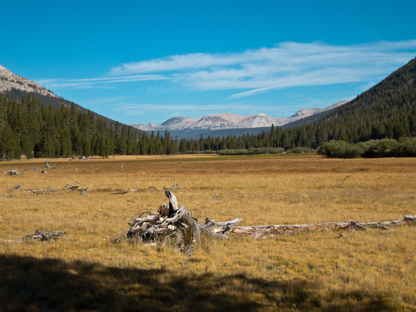
About an hour north of Whistler, BC lies a backcountry skiers paradise referred to as The Duffey, so named for Duffey Lake. It’s a stretch of Highway 99 between Pemberton and Lillooet that is flanked on either side by steep, glaciated peaks and endless powder. Pete and I got to spend six days exploring this Shangri la.
Day 1 – Oh look. It’s raining.
We drove out of Seattle at 6:30 am under intermittently rainy skies. We made good time to Bellingham, but had to make a few stops along the way for things like kerosene and a busted iPhone cord. After the requisite stop at Tim Horton’s for lunch and donuts, we pulled into the rain-soaked parking area for Cerise Creek at 1pm. Our destination, Keith’s Hut, is a rustic backcountry hut constructed by friends and family in memory of Keith Flavelle who died in a climbing accident in the 80’s. It is entirely supported by donations and a VERY popular destination. We opted to go here for Tues/Wed/Thurs nights in an effort to avoid the crowds and it worked out well! We arrived at the hut after 2.25 hours of skinning through rain and then increasingly driving snow to find only two other people there for the night. Marcela, from Argentina, and her boyfriend Steve, from London, were on a multi-month skiing and climbing trip through the US and Canada in a big touring van they picked up in Florida. They made great hut-mates! We were pretty soaked after our hike in so we laid our gear out to dry and started planning what to ski the next day.
Day 2 – Oh look. That’s a foot of new snow!
We awoke to clearing skies and a foot of powder. Sweetness. One of the great things about Keith’s Hut is that as soon as you walk out the door you can start climbing so you really get down to business straight away. The other great thing is that so much of the terrain is north facing it’s hard to go wrong. We left the hut with Steve and Marcela and climbed up the moraine towards the Anniversary glacier. We opted to take the northwest facing side of the moraine while Steve and Marcela took the northeast facing side. We bounced and giggled our way down through 1800 ft of soft, dry powder. This place was fun. We climbed back up the moraine for another lap, but this time followed Steve and Marcela’s tracks down the other side. The sun had taken a bit of a toll on the snow, but it was still deep and powdery. We found a skin track climbing up to a col on the east side of Mt. Matier and went up for a look around. We were rewarded with fantastic views and dramatic light shining on the Twin One Glacier, Mt. Howard and Snowspider Mountain. Back down more north-facing powder to another skin track climbing up the east side of the basin. These west-facing slopes had been rather cooked by the sun at that point so the snow was heavy and a little crusty, but still fun skiing! It was 5pm by that point and we were getting a little tired so we called it a day and headed back to the hut where we found several newcomers including an awesome family from Squamish comprising two wool-hatted, hippy tele skier parents and their jibbing teenage sons who built a kicker in back of the hut and proceeded to land backflip after backflip. So great.
Day 3 – Time to head for the bigger stuff.
The first day of touring was a bit of a pub crawl so we could get a feel for the place and try out the snow on different aspects. This day was a bit more objective-oriented. One of the classic skis in the area is the Anniversary glacier. Looking straight on is intimidating because it looks impossibly steep, but when you get up on it, you realize that’s just the effects of foreshortening and it’s really not that bad. We started the day with another 1800 ft lap off the moraine as we had the day before, this time skiing with Steve and Marcela. The clouds were coming and going so we wanted to give them some time to burn off before heading for the high alpine. On the next lap, Marcela took her poor fatigued legs and blistered feet back to the hut while Steve, Pete and I headed for the col at the top of the Anniversary glacier. We had very good visibility the whole way up and got some nice views across to Matier and Slalok. The ski down was on mostly great snow, though it had been slightly affected by the sun and wind from the previous day. This run affords you 2500 uninterrupted feet of skiing straight down. Needless to say our quads were on fire by the time we got to the bottom. We thought we’d call it a day after that, but Steve is very persuasive and enthusiastic and convinced us to go back up the moraine for a look at a steep little couloir that a couple guys had skied the day before. Looking down into it, I rubbed my tired legs and said no way, but Steve dropped in and reported that it wasn’t nearly as steep as it looked. So we went for it and are so glad we did! It was a fantastic little shot followed by more wide open rolling terrain that deposited us 300 grueling feet below the hut. We dug deep for that climb back up.
Day 4 – I can haz cheezburger?
Our original plan had been to ski to the car on day 4, collect more food and then ski up the other side of the road to another hut for three nights. Our overly-ambitious tours around Keith’s Hut (and concerns about the weather and snow conditions in the other hut’s basin) left us feeling tired and calorie-deprived and in need of the Wifi’s so instead, we bee-lined it for Pemberton, found a hotel, got into our street clothes and went to the Mile One restaurant for soul-soothing hamburger. I think they make their own buns. So. Good. We spent the rest of the day relaxing in the hotel hot tub, and being couch potatoes.
Day 5 – Back at it!
Feeling refreshed (and with only a daypack to carry now), we headed back up Highway 99 to check out the skiing on Mt. Chief Pascall. This north facing mountain rises 3000 feet up from the highway. We got to the ridge top and decided to run a few laps on the top 1000 feet to take advantage of the best snow. On each subsequent lap we noticed that the quality of the snow at the bottom of our run was increasingly heavy. It was obviously warming so after the next climb, we headed to the east side of Mt. Chief Pascall to ski a massive slide path called Equinox back down to the road. In good conditions, this run would be awesome. In heavy, tracked out and slightly crusty conditions, it was challenging to say the least. To add insult to injury, the run deposits you on a logging road 1.5 flat miles from your car so we got to do some sweet cross country skiing at the end of our day. After that it was back to the Pemberton Valley Lodge for more hot-tubbing and vegetating.
Day 6 – A private hut for me? Why yes, thank you!
Sunday we drove back up Highway 99 with our overnight packs reloaded with our sleeping bags and pads, camp stove, more food and kerosene for the heater. We were headed for the Wendy Thompson Hut, operated by the Alpine Club of Canada. We were still concerned about what the snow would be like since much of the terrain around it is south facing, but we’d gotten some new snow so we took our chances that the crust may have been covered. It’s about a three hour skin up the valley to the hut. We passed six skiers on their way out and they reported no one else up there. We arrived and sure enough had the entire place to ourselves. The weather was intermittently snowy and blowy with poor visibility so we hopped in some existing skin tracks to explore the little hills immediately surrounding the hut. We found very decent, though touchy snow so we kept it conservative and just did three little laplettes. We spent the evening playing cards by candlelight.
Day 7 – Right, so THERE are the bluebird conditions.

We awoke to perfectly sunny and windless conditions. Of course. Because it was time to go home. We headed out at 7:30 to get in some skiing and hopefully some views before we had to pack up. We found another nice little northeast facing powder stash and then climbed in to upper Marriott Basin in order to get views out to the south and west. The climb up was kind of sketchy, traversing under warming cornices, but nothing broke off and we were again rewarded with amazing views across to Joffre, Matier and Cayoosh. Many of our sentences at this point started with “Next time…” We were clearly hooked and would need to come back. We took one more run back to the hut and packed up our stuff. A much-quicker-than-expected slide out had us back to the car by 12:30 with visions of more Mile One cheeseburgers dancing in our heads. But oh, the horror! They’re closed on Mondays!!! We settled for some perfectly tasty paninis, great coffee and amazing vegan chocolate cake at The Mount Currie Coffee Company before hitting the road home. As usual, the drive back down the Sea-to-Sky highway was gorgeous and distracting, especially on this bluebird day.