Saturday, July 18, 2015

Sahale Peak climb

link to photo album


As the summer of ridiculously stable, sunny weather continues, Becky and I decided to do a quick trip up to the North Cascades.   We had originally thought about climbing Rainier this weekend, but we had family in town visting, so we couldn't be gone the whole weekend.
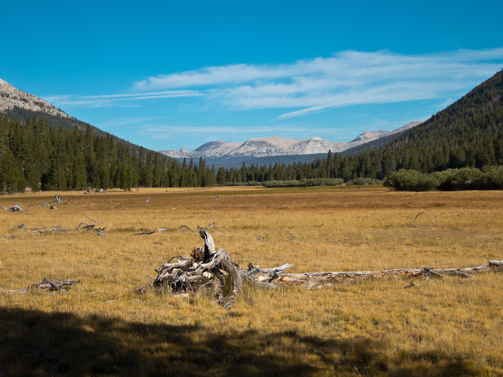
A Friday night drive up the Cascade River Rd and a five hour snooze in the back of the Subaru, and it was time to hit the trail. Headlamps on and up the trail we went at 4:30am.  There were other hikers/climbers car-camping nearby but no one was on the move yet.
The weather was cool and overcast for most of the ascent, it made the hike up seem pretty quick and relatively easy work.
No other hikers around so early in the morning, just birds, marmots, and a young male deer who appeared to prefer walking along the trail than bushwacking it.
As we neared the toe of the Sahale glacier, we saw a few groups of climbers milling about their tents, but still no one in front of us on the glacier or behind us on the trail...we were starting to think we were home-free to have zero traffic jams on the summit pinnacle.    As we got closer to the top of the glacier though, we spotted a big group...eight folks...all heading towards to the top.
By the time we caught up to them, they had one person just about ready to start leading the last bit to the top, so Becky and I pulled up a chunk of rock and sat down to wait for them.   After about an hour, their last climber was on the way up and Becky could finally get moving.  When the group opted to stop, pull up their rope and lead another pitch to the top, we finally asked if we could just sneak past...they were very friendly and let Becky zip on by and then reel me in.    Before even half of the big group of Mazamas were on the summit, we had our rappel rope tossed and were sliding back down the south side to the snow below.
After a little lunch break and stowing our climbing gear, we hit the trail back down Sahale Arm towards Cascade Pass and the parking lot.


Sunday, July 5, 2015

Mt.Olympus - Blue glacier route


 link to photo album


Earlier in the year, Andy had tossed out the idea of climbing Mt.Olympus over July 4th weekend.  Making plans months in advance, especially for an objective in the extremely wet Olympic Range rarely pans out, but we all penciled it in.   Fast forward to June and the disappointing ski season had basically wrapped up and the continued high pressure and perfect weather is making an Olympus climb look like a pretty likely destination for the Fourth. 
We put in a camping reservation form, so we wouldn’t have to deal with risking the long drive to Port Angeles only to find that all the campsites were booked already.   Mica, Andy, Andrew, Matt, Becky and I were all on different schedules, but we eventually made it to the Hoh rainforest trailhead.  
The approach to Olympus is just as much a challenge as the climb itself.  The trailhead is at 570 ft elevation and the approach to our camp at Glacier Meadows is 17.5 miles and 3,500 ft of climbing, the next day we’d have a 8-10 mile 4,000 ft day to reach the summit, and then Sunday we’d have that 17.5 hike out to look forward to.   Fortunately the forecast looked so ridiculously warm and dry we really didn’t need to bring much in the way of insulation or foul weather gear.
The hike in took about ten hours, but was mostly in the shade of massive old growth.  The only wildlife we saw was right out of the gate, just a half mile or so from the trailhead. Just off the trail we saw a black bear and her cub toodling along.  We kept our distance, but it was tough not to try and get closer to the cub that looked like moving stuffed animal.
 On the hike in and out Andy, Mica, Becky, and I had the wonderful distraction of listening to the same audiobook on our ipods.   Normally, I’d poo-poo the idea of separating myself from the sounds of nature by having headphones on, but when covering that many miles, it was great to have an entire book read to me through my headphones on the hike to camp.
We got to camp late in the afternoon, quickly ate dinner and guzzled tons of water.  Alarms set for 2am- from what we heard around the various campsites, most folks were getting a very early start due to the heat, the crowds, and the likelihood of a bottleneck of climbers at the short rock climb to the top of Olympus.
It was so warm that Becky and I used our sleeping bags as pillows- long underwear was more than enough to sleep in, but we all got a few hours of sleep before we were up.   A dark climb up past treeline got us to the lateral moraine of the Blue Glacier just as daylight started to arrive on the horizon.  
The Blue glacier has virtually no rockfall overlaying the ice on the lower reaches of the glacier and hardly any crevasses, which is fairly unique in the Northwest- most of the big glaciers turn into jumbled masses of cracks of dive below mounds of boulders lower on mountains.  On Olympus, you have a nearly mile-long walk across an undulating mass of bare ice enroute to the upper mountain. 
A short easy rock scramble/walk brought us from the lower glacier to the upper, snowy slopes of the Blue glacier.  Easy travel across the glacier, through Crystal Pass, and on up to the false summit, a few big crevasses and some moat issues to deal along the way.  Fortunately we got in front of a some big parties on the last bit of the climb and didn’t have too large of a queue waiting for the summit pinnacle.
Andy lead the short 5.3 pitch up the summit and Becky, Mica, and I followed along behind.   Andrew and Matt opted for the 4th class scramble route to avoid the wait for the 5th class option.   Unfortunately the masses on the summit and those behind us clogged up the descent route, so we waiting on top for about an hour and a half till we could drop our ropes and rappel back to the glacier. 
The descent went quickly, though the lower glacier was starting to get a little tiresome on our knees and feet…heavier-duty boots and steel crampons probably would’ve made for more comfortable walking, but our lightweight boots and aluminum crampons worked well enough.   We took a long break at a small tarn just above the meadows and soaked our feet.   Originally we thought we’d be back at camp by mid-afternoon but it was nearly 6pm by the time we were back at camp.
Another ridiculously warm night of sleeping with the rainfly off the tent and barely using our sleeping bags.   We were all up a couple hours before dawn and started the hike out by headlamp.   With our headphones continuing to distract us from the 17 miles and sore legs, we made pretty good time and were back to the parking lot by 1pm.     Nice to finally get Olympus, I imagine it’ll be a while before we do that long hike up the Hoh again any time soon. 


Sunday, June 7, 2015

Mt.Baker... last ski of the season?

 
For the past four years now, Becky and I have done a summer ski of Mt.Baker...usually as our last ski tour of the season.   Given how fast the snowpack is disappearing this season, we figured it was time to get Baker instead of waiting till mid-July like most years.
We've climbed Baker plenty of times as a day trip, but as our camping gear as become lighter and lighter, its pretty easy to toss the sleeping bag and tent into the pack and turn the jaunt into a leisurely overnighter.  We left Seattle in the early afternoon and were hiking up the Scott Paul trail around 4pm Saturday.   Lots of day hikers out and tons of cars in the parking lot, yet when we got to our favorite camping spot just below the Squak Glacier, there was no one there.   We assumed the masses must be one ridge over camping next to the Easton Glacier or just above us, but either way it was great to have peace and quiet.
After dinner, we stayed up till well after 10 watching the sunset, then set the alarm for 4am.  It was a very warm night... no need to even wear a hat in my tiny 1-lb 45 degree bag.    The snow on the lower Squak hadn't refroze overnight which made for easy skinning up the glacier in the morning.    It was breezier than expected, but with the warm temps it kept the ski up from feeling like being in an oven.   Quite a few more open crevasses than usual this time of year, I guess even the upper reaches of Baker had had a rough go of it this past winter. 
As we neared a bottleneck of climbers heading down near Sherman Crater, we figured out that one of the huge groups climbing the Easton glacier route was the Washington Alpine Club climbing class on their graduation climb.   We haven't done much with the WAC in ages, so we didn't expect to see many familiar faces, but we figured Pat was in the mix somewhere.   Sure enough, as we waited for some parties to cross a snowbridge, we spotted Pat....who introduced us as 'Becky and Pete are WAC members too....and I married them!'.   
After chatting with Pat for a bit and letting the traffic clear, we continued on up.   About halfway up the Roman Wall, the last slope to the summit, we switched from skis to crampons just to speed things up.    Lots of huge crevasses below the Roman Wall this year, but the route steered well clear of all but a couple.
As we reached the top, there were only two other skis and they were on their way down.  We didn't spend too much time on the summit as the snow didn't need any more softening to ski.
A quick uneventful ski back to camp through increasingly sticky and heavy snow and then we grabbed our camping gear and headed down.  A gully to the west of Crag View got us to within about 50 yards of the trail, and then it was time to rack the skis and don the sneakers.
 Might try one more ski on the north slopes of Rainier in a couple weeks or this might be it...hopefully next years ski season will be a bit longer. 


Tuesday, June 2, 2015

Spring skiing road trip - South Sister, Shasta, and Hood

 
Somehow Becky and I lucked out and our week of vacation lined up with some pretty nice weather. Even the day before we left, our itinerary was completely up in the air- completely dependant on weather and snow conditions...would we head north or south or who knows where.

Our little road trip started on Memorial Day weekend, but we figured that our prime destination of Mt.Shasta might be a bit of a zoo...so we pointed the car towards Central Oregon for a couple days.   We had a great ski of South Sister as a nice warm-up for the week. Clouds came and went through the day, but it was still warm and the snow was good, although a bit sticky and mushy. We made it back into Bend just in time to grab dinner with Dru, Jen and their kiddos. 

The next day, was to be the worst weather day on Shasta, so we delayed another day...took our time driving to California and headed over to Crater Lake. We'd been to Crater Lake several times with my family, but had never been there when there was still snow on the ground.  As we drove towards the lodge, we saw a steep, short little slope running from the road to the crater rim....that slope needed some ski tracks on it. After 30 minutes of scooting uphill we had a lovely view of the lake from our solitary perch on Hillman Peak and had a short, fun ski back down. As we got back to the car, a park service truck was waiting next to us. We were worried about being lectured, but as it turned out, the two fellows had been wanting to snowboard that pitch for a while and were stoked to see someone playing on it.

On to Shasta, where we arrived at Bunny Flat trailhead a bit before sunset. It was nearly deserted, though the overflowing trashcans showed just how busy it had been that weekend. The next morning we shuffled on up the trail towards Helen Lake and our camp at 10,500ft. After 1.7 miles and 1,000ft of hiking we reached the Sierra Club shelter at Horse Camp and could put our skis on snow. The ski up to Helen Lake was quick and we spent the rest of the afternoon relaxing in the sun and reading.

The next morning, we both felt great so we skipped our acclimatization day and headed on up. The few other climbers that were camped near us had left hours earlier, so we had a quiet climb to the summit only seeing a few other people. The top 1,000ft wasn't quite soft, but we wanted to avoid the afternoon clouds that seemed to build every day, so we skied down to top of the Red Banks and took a break for the snow to soften. Around noon, the snow was perfect corn and we flew down Avalanche Gulch. Back at camp, we refilled our water bottles, grabbed some lunch and went back up.  The afternoon heat was tremendous though and we didn't get more than about 1,100ft above camp before we ripped our climbing skins and skied back for the shade of the tent.

Rather than pack up camp, we decided to stick around for another day and ski Avy Gulch again.   Unfortunately, some high clouds on Thursday morning delayed the softening of the snow and our repeat ski wasn't quite as soft as Wednesday. Back at Helen Lake we broke camp and headed for the car. We managed to find a dirty gully of snow that got us a bit past Horse Camp and only had a bit more than a mile of hiking to get back to the car.

Friday morning, we pointed the car toward Northern Oregon to meet our family in Welches. The family was gathering that weekend at Mt.Hood to celebrate the scattering of my grandfather's ashes on the summit. I had been stressing over whether we'd get good enough weather to pull this off for a while, as we'd picked this weekend months ago, but the forecast looked great. As usual, we drove up to Timberline after dark and crashed in the back of the car. We left the car at 3am and saw a steady line of headlamps high on the mountain - lots of  folks had left around midnight.

We reached the top of the Palmer snowfield around sunrise, racked our skis and switched to boot crampons. As we got to the hogsback we had a great view of the masses above us crawling around. We had no interest in getting on the steeper terrain with so many guided parties and ill-prepared folks, but we took our time and started a slow traverse from the west and by the time we got to the old chute, everyone was out of sight. The chute was very firm, but the bootpack was good and there were plenty of ice axe holes for self-belaying. As we reached the top, we were thrilled that the morning crowds were gone and only one other climber was on the summit ridge. Becky and I got our picture taken with my grandfather's axe and some family photos and then the other climber headed down. Becky and I were able to have a quiet moment on the summit to release his ashes and then start down the chute before any other traffic showed up. By the time we reached our skis, the snow was softening.

We had a lunch date with our family at Timberline, so we couldn't wait around for softer snow, but we made good time and got to Timberline right around noon. Of all the times, I've climbed Hood, I never knew that the dining room had a buffet lunch. Pigging out for a couple hours while catching up with our family was a wonderful end to a week of sun and snow.  


Friday, September 5, 2014

SHR: post-trip, drive home

Post-trip:
Becky decided that she wanted to take the least-direct route home in order to stretch the vacation. We left Lee Vining at 1:30 on Thursday, 9/4 and started our migration north by way of Monitor Pass (so winding and fun to drive!), Lake Tahoe (so blue and populated by the wealthy!) and finally Truckee (so cute and straight out of Sunset magazine!). We purchased some personal hygiene products (since you can’t leave those in the car due to bears), got a last minute room at the Hotel Truckee Tahoe and took much-needed long, hot showers. The hotel was conveniently located across the street from the Fifty Fifty brewing company so we walked over, had tasty dinners, two beers each (great porter and a citrus-y ale!) and made it back to the hotel in time to catch the last quarter of the Seahawks game.

The next morning, we found a great coffee shop in downtown Truckee where we picked up a couple of delicious pastries and large coffees. We wandered the old-timey main street peering in the windows of the numerous cutesy shops and restaurants before getting back on the road at 9:30. Our next stop was Lassen National Park.

Our goal at Lassen was to visit the geothermal area known as Bumpass Hell. It’s the largest geothermal area west of Yellowstone! Along the way we discovered there is a  trail to the summit of Lassen Peak that is only 5 miles round trip and 2000 feet. We decided to tick another Cascade volcano off the list, but were dismayed to learn the trail is closed for restoration. Boo. We still got to hike in the 1.5 miles to Bumpass Hell to see the boiling mud pots, steaming fumeroles and yellow crystals of sufur dioxide that formed on the ground. Definitely worth a stop if you’re ever at Lassen.

Continued west to catch up to I-5 and stopped in Ashland for dinner at the Standing Stone Brewery. Only tried one beer here, a citrus-y ale, but it was very tasty and refreshing. We drove another 10 miles up to Medford where we knew we’d find cheaper accommodations, checked in to a hotel and crashed.

The next day we drove up to Eugene so we could wander the campus and Pete could reminisce about his days there. It was game day against the Michigan State Spartans and the whole city was crawling with people decked out in their finest Ducks gear. We looked into getting last minute tickets, but couldn’t stomach paying $109 each so we just got lunch at Burrito Boy, one of Pete’s favorite haunts from college, and pounded out the last five hours of driving back to Seattle. The cherry on the trip was that we got home in time to watch the Ducks trounce the Spartans on TV. A fine ending to a fabulous trip.


Thursday, September 4, 2014

SHR Day 10: Lyell Canyon

Day 10: Lyell Canyon

We had 12 downhill/flat trail miles to get back to the car and figured it would take us about five hours so we were off by 7am. Becky’s feet had de-swelled overnight enough to get her blistered toe into her shoe with relative ease, but she knew that as soon as the heat came up, her feet would puff out again and pinch her poor abused toes so we walked as fast as we could.

Becky’s goal was to get to the car in time to get to the Whoa Nellie Deli in Lee Vining by lunch. Mission accomplished. We walked into the Dog Lake Parking lot a few minutes before noon, located our car that Andy and Mica had deposited there one week prior, disrobed and shoved our filthy trail clothes into a garbage bag and headed down the Tioga Pass Road to Lee Vining where we ordered a cheeseburger and fries and lobster taquitos from the deli. We’re not entirely sure where the “lobster” came in to those taquitos, it was more of a refried bean consistency with a slightly lobster-y flavor, but it tasted good and more importantly, came with a pile of fresh vegetables so we ate every last bite.


Wednesday, September 3, 2014

SHR Day 9: Donahue Pass

Day 9: Donahue Pass

The wind howled that night and the flapping of the tent fly kept Becky awake for four hours. During this time she decided that damaged appendages + no sleep = take the obvious route home. It was really tough to abandon the SHR as we knew the next section would offer some amazing, rarely visited terrain, but Becky was not sure she could make it through another 11 miles of rough travel safely.

We struck off overland to intersect the JMT a couple miles north. It was both strange and comforting to be back on that highway. We climbed up to Donohue Pass, greeting the throngs of southbound JMT travelers along the way. When we hiked the JMT in 2010 we didn’t notice that many people on the trail, but that’s because we were all traveling north to south. When you’re swimming upstream, it really becomes clear just how popular this trail is.

We stopped at a tarn on the other side of Donohue Pass above Lyell Canyon and Becky inspected her feet. She discovered a blister had formed on her right pinky toe that encompassed the whole end of her toe and swelled it to half again its normal size. This caused great discomfort in her hiking shoe and we decided to put down camp after another mile of limping down the trail.

We enjoyed our last night on the trail - reading, napping, eating and taking in the last of the high-alpine views. We knew the next day’s return to the car meant much-anticipated clean clothes and cheeseburgers, but we were sad to be leaving the peace and tranquility of the high Sierra.