Saturday, September 4, 2010

JMT Day 5 / September 4, 2010 - Lake Virginia, Squaw Lake

stats: 15.5 miles, 2500' gain

Up at 5:30 again and on the trail by 6:30. Before we left camp though we met our neighbor…we didn’t get his name, but we had recognized him as a fellow from New York that another hiker had mentioned the other day. ‘New York’ appeared to be having a pretty rough time…we’d seen his pack the day before…it was huge compared to the average JMT’er…and he’d been complaining of having back pain. He’d been trying to make up time by traveling after dark, but had gotten turned around by taking a small unmarked trail off the main trail in the night and walked miles back and forth before finally plopping down next to our tent. When we left him that morning he was off exploring adjacent spur trails (with his tent WIDE open for all manner of critter to easily enter), seemingly unwilling to accept that the highway the rest of us were on was in fact the correct trail.

We felt great in spite of our long, hot 22-mile day and were making good time, but by mid-morning things took a turn for the worse. Without going into too much detail, lets just say I became violently ill, my stomach was a train-wreck, and I was running a fever by 10am. Becky slowed the pace, and we crawled along far slower than the day before. We reached Purple Lake by lunchtime. Becky made sandwiches and refilled our reservoirs while I fell asleep in the shade. Fortunately the handful of Aleve I took finally started to knock my fever down and we still managed to grind out 15.5 miles that day. The day’s hike ended with a hot 1000’ climb out of Tully Hole to Squaw Lake which only drove home how much we prefer to do our climbing in the cool of the morning.

The terrain we covered was really quite spectacular though, we briefly got above treeline into a rocky bowl filled with house-sized granite boulders, and passed by more amazing lakes. Lake Virginia was our favorite…not particularly big, but the most intense shade of blue with bright green meadows that ran right to the lakeshore which was rimmed with beaches of pulverized granite sand. We could’ve easily spent the day lounging there, but the downside to a two-week schedule is that we couldn’t just drop the packs and set up camp that early in the afternoon.

Squaw Lake was a great campsite though, and we rolled in to camp with enough sunlight left to soak our tired legs and wash our socks. It was Labor Day weekend and after several days of relative peace and quite, we were a little annoyed to have to share ‘our lake’ with campers who were way to noisy and boisterous.

I passed out early, trying to gather some strength for Silver Pass and the ten miles out to the water taxi the next day.

Day 6…

Link to photo album

Mammoth Crest

Purple Lake

Lake Virginia

Squaw Lake

Dinnertime on the slabs at Squaw Lake

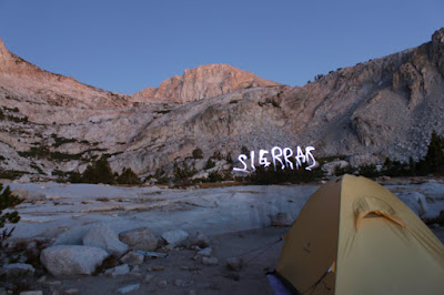
Fun with long exposures and a headlamp at camp

Friday, September 3, 2010

JMT Day 4 / September 3, 2010 - Reds Meadow, Mammoth Crest

stats: 21.5 miles, 2500' gain

This was the first day we gave the new “Frank strategy” a try. Rather than get up with the sun and start the day at a leisurely hour, we set the alarm for 5:30am and began what would become our regular routine of eating breakfast by headlamp, breaking camp at first light and being on the trail by 6:30. 

The day was hot, the trail was an awful combination of dust, loose dirt, and way too much horse shit from all the mule trains and guided trips in the area.  We dropped out of the alpine, past Devil’s Postpile National Monument (we didn’t take the side trail to get the up-close view – the view from across the river was just fine for us), and down to the edge of Mammoth where we took a mid-afternoon break at Reds Meadow Resort.  Some JMT hikers pick up their first resupply packages at this camp, but our first resupply was still a few days away at Vermillion Valley Resort.   Though we didn’t have any food to pick up, we were pretty happy to raid the small grocery store and get some cold Gatorade and popsicles before heading back out into the afternoon heat.  The next stretch beyond Red’s had burned a few years past, so there was no shade, but it was tolerable thanks to our long break and as we got back into the shade and climbed the 1300’ to Mammoth Crest we felt surprisingly good with our slow and steady pace.  By the time we dropped our packs for the night at Duck Creek, we’d covered almost 22 miles.  Frank’s method for covering a lot of ground was a good one! 

Around 10pm we heard someone walking by, then about a half-hour later we heard the noise again…someone was rolling in way after dark and was setting up camp near us.   He was quiet and we didn’t mind having a neighbor, but it seemed a little odd for someone to be hiking so late. 

Day 5…

Link to photo album


Becky cooling off at Red’s Meadow Resort

A hot hike through the old burn to Mammoth Crest

Thursday, September 2, 2010

JMT Day 3 / September 2, 2010 - Donahue Pass, Ritter Range

stats: 14 miles, 3000' gain

Kind of a slow start this morning. We didn’t break camp till 7:30.  After many miles of flat valley bottom hiking, we finally climbed out of the trees and up into the subalpine wonder below Mt.Lyell…tons of small tarns, creeks, meadows, huge granite domes…it really was as we expected - like Washington’s Enchantments, but on steroids.  Up over Donahue Pass, 11,056ft, and we finally had some new views to the south, June Mountain, and the Mammoth ski area were visible in the distance.  

On our hike up to the pass we met and passed fellow thru-hiker Frank. Frank’s approach to hiking was slow and steady and go ALL day. While we initially congratulated ourselves on being fast enough to pass other hikers, we found our energy sapped and our feet sore by early afternoon. As we lazed about, soaking our fatigued limbs in a lake later that afternoon we saw Frank slowly make his way past the lake, still cranking with three hours til sunset.  We knew then that Frank had the right idea and we’d have to adopt his strategy if we were going to happily put in 15-20 miles a day for 14 days in a row.  We referred to our new pace as “Franking it”. 

While having a mid-morning snack on the top of Donahue, a mouthful of chocolate covered raisins provided just enough stickiness to loosen a temporary crown I had over one of my molars, and before I knew it, I had pulled off the crown and there it was in the palm of my hand.  I’d heard horror stories of tooth pain hikers have had from losing fillings before, but fortunately a crown popping off a dead tooth that’s had a root canal only makes for awkward eating. 

The warm morning gave way to a hot afternoon…we found a patch of shade near a stream for lunch, refilled our water reservoirs, wetted our bandanas and hats and headed towards Island Pass. 

Just beyond Island Pass is Thousand Island Lake, a spot I’d been dying to see ever since I first started researching the JMT last year.  There’s no way for me to describe it…it just looks so amazing, a deep blue lake below a huge black peak, and what truly seems like a thousand tiny islands dotting the water.  It would’ve been easy to camp here, but we still needed to knock off a few more miles, so we continued on to the equally spectacular Garnet Lake where we had camp set up by 3:30. 

The weather was still plenty warm for a relaxing afternoon of swimming and doing laundry on the lakeshore.  We didn’t bring many changes of shorts and socks, so after three days our first set of socks were fairly caked with dust…it was nice to be able to get them cleaned and dried for the next day. 

Becky and I both had been looking forward to tonight's dinner….we had a sealed package of pre-cooked bacon that we finally cracked open and added to our lentils and couscous…so nice to get some fat and salt! 

The evening weather was warm and we didn’t need our down jackets after dark…made for a pleasant night of sleeping, but the next day was likely to be really hot.

Day 4…

Link to photo album


Tarns below the Lyell Glacier


closing in on Donahue Pass


Thousand Island Lake

Wednesday, September 1, 2010

JMT Day 2 / September 1, 2010 - Tuolumne Meadows, Lyell Canyon

stats: 18 miles, 300' gain
 
We both felt surprisingly good in the morning, our feet and legs recovered from the big start the day before.  A cup of Starbucks instant VIA coffee with some cold cereal and we were on our way.  Not much climbing today, just a little 300’ climb over Cathedral Pass, down to Tuolumne Meadows and then south to the head of Lyell Canyon.  As we neared Tuolumne, we got a bit turned around with the jumble of trails, but one of the volunteers at the Visitors Center got us going in the right direction to the hamburger stand.  We gobbled up burgers, fries, and fruit salad, and picked up a few last minute first-aid items at the store then left civilization behind and started up the canyon. 

Lyell Canyon was gorgeous…big meadows with tall grass and a slow flowing stream with one tempting swimming hole after the next.   We kept hiking till about 4:30 when Becky started to fade and began to stumble on rocks and roots and such…and I was more than happy to call it a day too. 

As we set up camp a large group of guided hikers walked back and forth on the trail…they were part of a horse-packing trip and the guides, horses, and all the overnight gear were nowhere to be found.  Fortunately about an hour before dark, the hiking guide found some evidence of where the pack-train had left the trail and the group headed to find their camp…I was glad we didn’t have to start donating food and fuel to a big group that had lost their way. 

We got in a quick dip in Lyell Creek before the sun dipped below the ridgeline and cooled things off.   The one drawback to using running shoes on such a dry trail is that ones feet are filthy at the end of the day from all the dust getting through the light mesh fabric. 

Becky started to look at the schedule and maps (an exercise on her part that would become a near-obsessive nightly ritual :) ) and suggested that we try to up the daily mileage so that we get to our food resupply a half-day earlier, but that would mean we’d be doing at least one 20+ mile day and I hoped that she would reconsider as I was not eager to start putting in big-mileage days unless necessary. 

Tomorrow would be our first big pass, Donahue Pass, then we’d leave Yosemite and head for camp in the Ritter/Banner area.

Day 3…

Link to the photo album


Cathedral Peak, nearing in on Tuolumne Meadows

way up Lyell Canyon, looking back towards Tuolumne

Tuesday, August 31, 2010

JMT Day 1 / August 31, 2010 - Yosemite Valley to Sunrise

stats: 13 miles, 5320' gain

Time to finally start hiking! We got up at 6am and were all packed by 6:45. We walked over to Curry Village, the restaurant/store hub in Yosemite Valley and had our final ‘real’ cups of coffee and pastries then it was off to the trailhead. Becky wanted to walk the mile and a half to the trailhead, but fortunately a shuttle bus stopped right next to us, so we hopped onboard and got a quick lift to the end of the road.
We got our picture taken at the trailhead sign that lists the mileage to all the major landmarks, the last line of the sign reads ‘Mt.Whitney summit, 211 miles’….guess we have our work cut out for us.
The trail past all the various waterfalls went a bit slower than last year as we were now loaded down with overnight gear and our first week’s supply of food, but the weather was sunny and pleasantly cool.
Originally, we were unable to get a permit to start from the traditional beginning of the JMT in the valley bottom, the Happy Isles trailhead, and we could only get a permit to start from Glacier Point, but there were enough first-come first-served permits the day before that we were able to switch things around and start from Happy Isles. The good thing was that we could then hike the full JMT, start early in the morning, and save $25 each for bus ride up to Glacier Point…the only bad thing was starting from the valley bottom added 3200’ of climbing to our first days travel.
The Happy Isles trailhead is also the starting point for day hikers heading to Half Dome, probably the most popular big hike in the park, and we shared the trail with a sea of humanity until we reached the Half Dome turn-off….from there on out, we largely had the trail to ourselves.
By late afternoon we were grinding up the last of the 5300’ of climbing and our pace had certainly slowed as our lungs weren’t quite used to hiking at 9500ft just yet, but we reached our first camp, Sunrise, at 3:30pm and spent the afternoon doing lots of stretching and rehydrating. The backpackers camping area at Sunrise was pretty full by evening and some stragglers were still rolling in after dark.
There were lots of friendly backpackers staying at Sunrise, a big group of folks from Colorado, some well into their mid-70’s…it was a kick to see folks of their age still hefting packs and running around in the alpine.
Sunrise has seasonal tent-cabins and provides catered meals for those with big budgets… we tried not to think about the fancy food others were eating nearby as the cook rang the dinner bell and we ate our simple one-pot meal.
Off to bed early and looking forward to our next day of hiking.

Day 2...
Link to the photo album


Becky and I at the Happy Isles trailhead...the last time we'll be clean for a while


Leaving Half Dome behind on the way to Sunrise

Monday, August 30, 2010

John Muir Trail: planning, logistics, gear, getting started

The John Muir Trail is a 211-mile high route that travels through the heart of the Sierras from Yosemite Valley to the summit of Mt.Whitney (the highest peak in the lower 48)...add in the 10.5 miles to get from Whitney's summit down to your car, and you've got an epic 221.5 mile thru-hiking trip!

Last summer while working in San Fran, I did a weekend trip out to Yosemite to hike Half Dome and Clouds Rest.... I'd certainly heard of the Pacific Crest Trail before, but the JMT was new to me. The JMT shares much of its route with the PCT, but unlike the PCT in Oregon and much of Washington, down in California, the trail runs high above treeline quite a bit, crossing numerous mountain passes above 11,000ft.

After my weekend day hike in Yosemite, seeing folks with tiny lightweight backpacks heading out for 2-3 week long adventures, wearing little more than running shorts and sneakers, the idea of checking out the JMT really got stuck in my brain.

Fast forward to this year, Becky and I were able to get away from work for three weeks, and we were eager to get down to the Sierras to hike the Muir Trail.

For a trip of this duration in the northwest, we'd have brought all sorts of foul weather gear, a waterproof tent, a white gas stove, all sorts of insulation, and waterproof boots...but for this trip we got to keep our packs fairly light and simple, which made high-mileage days feasible. We used an Epic fabric single-wall tent, a butane canister stove, 40-45 degree sleeping bags, and wore low-top trail running shoes.

Over two days we drove from Seattle to Mammoth Lakes, where we stayed for two nights taking care of all the final logistics. We had expected the weather to be sunny and warm on the east side of the Sierras, but we had also seen the latest forecast calling for an unseasonably strong low pressure system to hit the area during our first day in Mammoth…we had a few worries about the weather and our lightweight gear our first morning in Mammoth when we went out for breakfast and there were snowflakes falling from the sky. It looked like the weather was to return to normal by the time we started hiking though, so we tried not to worry about our water-resistant tent (not water-proof) and summer-weight sleeping bags.

Getting our car to the Whitney Portal trailhead and then getting ourselves 200 miles north to Yosemite took a little time. For those with an unlimited budget and no time, its possible to hire a private shuttle to take you up to Yosemite after you've dropped your car off at the southern terminus of the JMT, or for those with no budget and lots of time, its feasible to hitchhike your way back to Yosemite...but we didn't quite fit into either category. Public transit does exist on the east side of the Sierras, and lots of folks take a ESTA bus from Whitney's closest town, Lone Pine, to Mammoth and the the next day take another bus from Mammoth to Yosemite. We were eager to get the hiking started as fast as possible, but didn't want to fork over the money for a private shuttle, so our compromise was to pick up a rental car in Mammoth, then we drove both cars down to Whitney, left Becky's car behind and returned to Mammoth. The following day in Mammoth we hopped on the YARTS bus and for $15 each got a nice bus ride on into Yosemite Valley. The rental car/bus combo was a bit more spendy than the bus only option, but saved us from having to spend an extra day kicking around Mammoth.

Once in Yosemite Valley we picked up our permit, set up camp for the night, and spent the rest of the day being tourists...walking to the base of El Cap, taking lots of pictures, doing last minute gear checks, and generally being rather nervous about what exactly we had in store over the next two weeks.

Day 1…

Link to the photo album

Here's an elevation profile of the trip...the first day is a biggy, 5600 vertical feet, then a series of small passes and climbs for the first week. The second week things get a little higher and the ups and downs get a lot bigger.


Becky at the Mono Lake overlook on the drive down to Mammoth

Hanging out in Yosemite Valley…the start of the JMT is just right over there.

Becky at the base of El Capitan


Friday, July 23, 2010

Glacier Peak ski (and a surprise on the summit)

link to photo album


Last weekend was busy...right after work Becky and I were off to Lake Union for a friend's wedding, and then at 9pm we piled into the Subaru and were off to the Mountain Loop Highway...we had a long hike ahead of us on Saturday, so we figured sleeping at the trailhead made sense. Becky was a trooper and drove the whole way while I did my best to remain awake. A cramped night snoozing in the back of the car and then we were up at first light, guzzling coffee and eating Twinkies (well, I was...Becky had a much healthier breakfast).
Glacier Peak has never been particularly easy to access, but since the floods a few years ago wiped out the Kennedy Hotsprings trail, the most reasonable way to get to the mountain has been 10 miles of trail hiking, then three miles of cross country skiing just to get to camp, then another three miles the following day to reach the top, with a total of about 9000 vertical feet of gain. We skimped on gear as much as possible...no tent, minimal glacier gear, and our lightweight summer sleeping bags...we hoped that a 40 degree down bag with all our clothes on would be warm enough.
Fortunately the high clouds stuck around Saturday morning as we made quick work of the first five miles of flat trail and then chipped away at all the switchbacks that got us to White Pass by lunchtime. The weather was starting to clear, and our packs got a little lighter when we could finally switch from running shoes to skis and boots. A quick slide down into Whitechuck basin, and we put the skins on and shuffled the remaining miles to Glacier Gap. We rolled into camp at 4:30pm and found one spot that had some wind protection and a small rock wall.
The marine layer clouds came and went, billowed up and then faded...I think mother nature was toying with us as we'd opted to skip bringing a tent and we were both a little nervous about how damp our night could be in our thin down bags and flimsy bivy sacks should the weather not cooperate.
We both slept poorly, I think we've gotten used to sleeping in tents, vs out in the open, and a glimpse of a curious chipmunk earlier in the evening has us on our toes for critters that might come to nibble our food or backpack straps.
Just as we were starting to get cold, the alarm went off and it was time to rise and shine. After a cold breakfast and a few caffeinated gu's to get us awake we were off again, hiking the last three miles to the top. We opted to crampon cause the snow has frozen rather firmly overnight, but a pair of skiers who camped near us did just fine with skins and ski crampons. 
Up Gerdine Ridge and out across the Gerdine glacier, the views of the Dakobed range started to open up....we were both feeling the effects of the fourteen mile day Saturday and weren't breaking any speed records. Slow and steady progress up the Cool Glacier, past a few small crevasses and then we were on the pumice ridge just a thousand feet below the summit. It was plenty warm, but the western aspect of the Sitkum glacier side kept the top few hundred feet of the mountain rather icey. We figured by the time we slowly dawdled our way to the top and had a break, the top would be soft enough for a pleasant ski.
Mark and Andy, two guys who'd camped near us the day before and were the only other folks on the mountain today, had beaten us to the top by a good half-hour and were on their way down as we topped out. Becky and I were rather surprised that on a beautiful sunny Sunday afternoon, there was no one else on the summit. The view was great, the weather warm, the snow was softening....it was perfect. Becky noted that once Glacier Peak was in the bag, we'd skied all the Washington volcanoes together.
The day before while hiking through a huge meadow of yellow flowers, I picked one and put it in my camera bag...just in case....there was something I had been planning to ask Becky while we were backpacking later this summer in the Sierras, but having the summit of Glacier all to ourselves seemed like a good place to....ask her to marry me. I took the wildflower I had in my camera bag, tied it into a ring, got down on one knee, and asked Becky to marry me. And fortunately she said yes.
The ski down off the summit was wonderful, good snow, and we were both in high spirits. I've never seen Becky so happily tackle such a long day in the mountains before...I guess she must've been in a good mood :)
We quickly skied down the Cool and Gerdine glaciers and rolled into camp...our damp sleeping bags dried quickly in the sun and by noon we were packed up and skiing back out the Whitechuck basin towards White Pass. Once at White Pass, we shotgunned more caffeinated gu, donned the running shoes and just tried to pound out the miles to the car. Shortly after 8pm we were back at the car and on our way home...sunburned, tired, and happily engaged :)