Wednesday, September 1, 2010

JMT Day 2 / September 1, 2010 - Tuolumne Meadows, Lyell Canyon

stats: 18 miles, 300' gain
 
We both felt surprisingly good in the morning, our feet and legs recovered from the big start the day before.  A cup of Starbucks instant VIA coffee with some cold cereal and we were on our way.  Not much climbing today, just a little 300’ climb over Cathedral Pass, down to Tuolumne Meadows and then south to the head of Lyell Canyon.  As we neared Tuolumne, we got a bit turned around with the jumble of trails, but one of the volunteers at the Visitors Center got us going in the right direction to the hamburger stand.  We gobbled up burgers, fries, and fruit salad, and picked up a few last minute first-aid items at the store then left civilization behind and started up the canyon. 

Lyell Canyon was gorgeous…big meadows with tall grass and a slow flowing stream with one tempting swimming hole after the next.   We kept hiking till about 4:30 when Becky started to fade and began to stumble on rocks and roots and such…and I was more than happy to call it a day too. 

As we set up camp a large group of guided hikers walked back and forth on the trail…they were part of a horse-packing trip and the guides, horses, and all the overnight gear were nowhere to be found.  Fortunately about an hour before dark, the hiking guide found some evidence of where the pack-train had left the trail and the group headed to find their camp…I was glad we didn’t have to start donating food and fuel to a big group that had lost their way. 

We got in a quick dip in Lyell Creek before the sun dipped below the ridgeline and cooled things off.   The one drawback to using running shoes on such a dry trail is that ones feet are filthy at the end of the day from all the dust getting through the light mesh fabric. 

Becky started to look at the schedule and maps (an exercise on her part that would become a near-obsessive nightly ritual :) ) and suggested that we try to up the daily mileage so that we get to our food resupply a half-day earlier, but that would mean we’d be doing at least one 20+ mile day and I hoped that she would reconsider as I was not eager to start putting in big-mileage days unless necessary. 

Tomorrow would be our first big pass, Donahue Pass, then we’d leave Yosemite and head for camp in the Ritter/Banner area.

Day 3…

Link to the photo album


Cathedral Peak, nearing in on Tuolumne Meadows

way up Lyell Canyon, looking back towards Tuolumne

Tuesday, August 31, 2010

JMT Day 1 / August 31, 2010 - Yosemite Valley to Sunrise

stats: 13 miles, 5320' gain

Time to finally start hiking! We got up at 6am and were all packed by 6:45. We walked over to Curry Village, the restaurant/store hub in Yosemite Valley and had our final ‘real’ cups of coffee and pastries then it was off to the trailhead. Becky wanted to walk the mile and a half to the trailhead, but fortunately a shuttle bus stopped right next to us, so we hopped onboard and got a quick lift to the end of the road.
We got our picture taken at the trailhead sign that lists the mileage to all the major landmarks, the last line of the sign reads ‘Mt.Whitney summit, 211 miles’….guess we have our work cut out for us.
The trail past all the various waterfalls went a bit slower than last year as we were now loaded down with overnight gear and our first week’s supply of food, but the weather was sunny and pleasantly cool.
Originally, we were unable to get a permit to start from the traditional beginning of the JMT in the valley bottom, the Happy Isles trailhead, and we could only get a permit to start from Glacier Point, but there were enough first-come first-served permits the day before that we were able to switch things around and start from Happy Isles. The good thing was that we could then hike the full JMT, start early in the morning, and save $25 each for bus ride up to Glacier Point…the only bad thing was starting from the valley bottom added 3200’ of climbing to our first days travel.
The Happy Isles trailhead is also the starting point for day hikers heading to Half Dome, probably the most popular big hike in the park, and we shared the trail with a sea of humanity until we reached the Half Dome turn-off….from there on out, we largely had the trail to ourselves.
By late afternoon we were grinding up the last of the 5300’ of climbing and our pace had certainly slowed as our lungs weren’t quite used to hiking at 9500ft just yet, but we reached our first camp, Sunrise, at 3:30pm and spent the afternoon doing lots of stretching and rehydrating. The backpackers camping area at Sunrise was pretty full by evening and some stragglers were still rolling in after dark.
There were lots of friendly backpackers staying at Sunrise, a big group of folks from Colorado, some well into their mid-70’s…it was a kick to see folks of their age still hefting packs and running around in the alpine.
Sunrise has seasonal tent-cabins and provides catered meals for those with big budgets… we tried not to think about the fancy food others were eating nearby as the cook rang the dinner bell and we ate our simple one-pot meal.
Off to bed early and looking forward to our next day of hiking.

Day 2...
Link to the photo album


Becky and I at the Happy Isles trailhead...the last time we'll be clean for a while


Leaving Half Dome behind on the way to Sunrise

Monday, August 30, 2010

John Muir Trail: planning, logistics, gear, getting started

The John Muir Trail is a 211-mile high route that travels through the heart of the Sierras from Yosemite Valley to the summit of Mt.Whitney (the highest peak in the lower 48)...add in the 10.5 miles to get from Whitney's summit down to your car, and you've got an epic 221.5 mile thru-hiking trip!

Last summer while working in San Fran, I did a weekend trip out to Yosemite to hike Half Dome and Clouds Rest.... I'd certainly heard of the Pacific Crest Trail before, but the JMT was new to me. The JMT shares much of its route with the PCT, but unlike the PCT in Oregon and much of Washington, down in California, the trail runs high above treeline quite a bit, crossing numerous mountain passes above 11,000ft.

After my weekend day hike in Yosemite, seeing folks with tiny lightweight backpacks heading out for 2-3 week long adventures, wearing little more than running shorts and sneakers, the idea of checking out the JMT really got stuck in my brain.

Fast forward to this year, Becky and I were able to get away from work for three weeks, and we were eager to get down to the Sierras to hike the Muir Trail.

For a trip of this duration in the northwest, we'd have brought all sorts of foul weather gear, a waterproof tent, a white gas stove, all sorts of insulation, and waterproof boots...but for this trip we got to keep our packs fairly light and simple, which made high-mileage days feasible. We used an Epic fabric single-wall tent, a butane canister stove, 40-45 degree sleeping bags, and wore low-top trail running shoes.

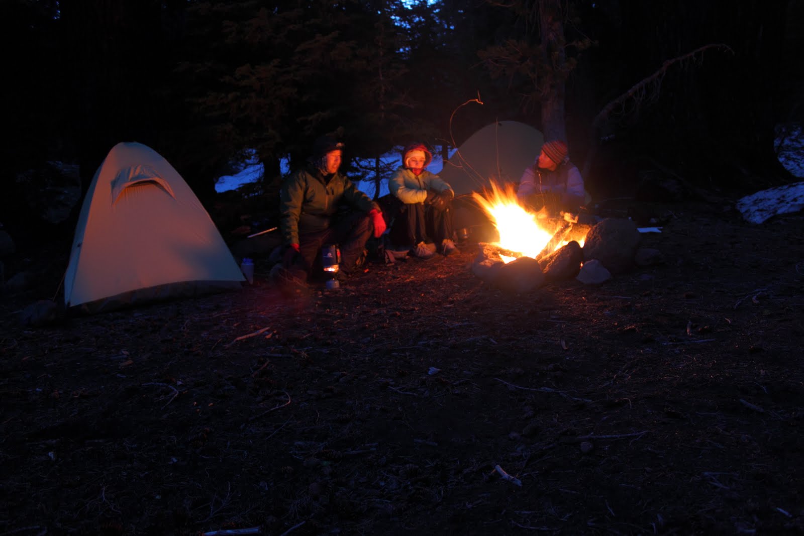
Over two days we drove from Seattle to Mammoth Lakes, where we stayed for two nights taking care of all the final logistics. We had expected the weather to be sunny and warm on the east side of the Sierras, but we had also seen the latest forecast calling for an unseasonably strong low pressure system to hit the area during our first day in Mammoth…we had a few worries about the weather and our lightweight gear our first morning in Mammoth when we went out for breakfast and there were snowflakes falling from the sky. It looked like the weather was to return to normal by the time we started hiking though, so we tried not to worry about our water-resistant tent (not water-proof) and summer-weight sleeping bags.

Getting our car to the Whitney Portal trailhead and then getting ourselves 200 miles north to Yosemite took a little time. For those with an unlimited budget and no time, its possible to hire a private shuttle to take you up to Yosemite after you've dropped your car off at the southern terminus of the JMT, or for those with no budget and lots of time, its feasible to hitchhike your way back to Yosemite...but we didn't quite fit into either category. Public transit does exist on the east side of the Sierras, and lots of folks take a ESTA bus from Whitney's closest town, Lone Pine, to Mammoth and the the next day take another bus from Mammoth to Yosemite. We were eager to get the hiking started as fast as possible, but didn't want to fork over the money for a private shuttle, so our compromise was to pick up a rental car in Mammoth, then we drove both cars down to Whitney, left Becky's car behind and returned to Mammoth. The following day in Mammoth we hopped on the YARTS bus and for $15 each got a nice bus ride on into Yosemite Valley. The rental car/bus combo was a bit more spendy than the bus only option, but saved us from having to spend an extra day kicking around Mammoth.

Once in Yosemite Valley we picked up our permit, set up camp for the night, and spent the rest of the day being tourists...walking to the base of El Cap, taking lots of pictures, doing last minute gear checks, and generally being rather nervous about what exactly we had in store over the next two weeks.

Day 1…

Link to the photo album

Here's an elevation profile of the trip...the first day is a biggy, 5600 vertical feet, then a series of small passes and climbs for the first week. The second week things get a little higher and the ups and downs get a lot bigger.


Becky at the Mono Lake overlook on the drive down to Mammoth

Hanging out in Yosemite Valley…the start of the JMT is just right over there.

Becky at the base of El Capitan


Friday, July 23, 2010

Glacier Peak ski (and a surprise on the summit)

link to photo album


Last weekend was busy...right after work Becky and I were off to Lake Union for a friend's wedding, and then at 9pm we piled into the Subaru and were off to the Mountain Loop Highway...we had a long hike ahead of us on Saturday, so we figured sleeping at the trailhead made sense. Becky was a trooper and drove the whole way while I did my best to remain awake. A cramped night snoozing in the back of the car and then we were up at first light, guzzling coffee and eating Twinkies (well, I was...Becky had a much healthier breakfast).
Glacier Peak has never been particularly easy to access, but since the floods a few years ago wiped out the Kennedy Hotsprings trail, the most reasonable way to get to the mountain has been 10 miles of trail hiking, then three miles of cross country skiing just to get to camp, then another three miles the following day to reach the top, with a total of about 9000 vertical feet of gain. We skimped on gear as much as possible...no tent, minimal glacier gear, and our lightweight summer sleeping bags...we hoped that a 40 degree down bag with all our clothes on would be warm enough.
Fortunately the high clouds stuck around Saturday morning as we made quick work of the first five miles of flat trail and then chipped away at all the switchbacks that got us to White Pass by lunchtime. The weather was starting to clear, and our packs got a little lighter when we could finally switch from running shoes to skis and boots. A quick slide down into Whitechuck basin, and we put the skins on and shuffled the remaining miles to Glacier Gap. We rolled into camp at 4:30pm and found one spot that had some wind protection and a small rock wall.
The marine layer clouds came and went, billowed up and then faded...I think mother nature was toying with us as we'd opted to skip bringing a tent and we were both a little nervous about how damp our night could be in our thin down bags and flimsy bivy sacks should the weather not cooperate.
We both slept poorly, I think we've gotten used to sleeping in tents, vs out in the open, and a glimpse of a curious chipmunk earlier in the evening has us on our toes for critters that might come to nibble our food or backpack straps.
Just as we were starting to get cold, the alarm went off and it was time to rise and shine. After a cold breakfast and a few caffeinated gu's to get us awake we were off again, hiking the last three miles to the top. We opted to crampon cause the snow has frozen rather firmly overnight, but a pair of skiers who camped near us did just fine with skins and ski crampons. 
Up Gerdine Ridge and out across the Gerdine glacier, the views of the Dakobed range started to open up....we were both feeling the effects of the fourteen mile day Saturday and weren't breaking any speed records. Slow and steady progress up the Cool Glacier, past a few small crevasses and then we were on the pumice ridge just a thousand feet below the summit. It was plenty warm, but the western aspect of the Sitkum glacier side kept the top few hundred feet of the mountain rather icey. We figured by the time we slowly dawdled our way to the top and had a break, the top would be soft enough for a pleasant ski.
Mark and Andy, two guys who'd camped near us the day before and were the only other folks on the mountain today, had beaten us to the top by a good half-hour and were on their way down as we topped out. Becky and I were rather surprised that on a beautiful sunny Sunday afternoon, there was no one else on the summit. The view was great, the weather warm, the snow was softening....it was perfect. Becky noted that once Glacier Peak was in the bag, we'd skied all the Washington volcanoes together.
The day before while hiking through a huge meadow of yellow flowers, I picked one and put it in my camera bag...just in case....there was something I had been planning to ask Becky while we were backpacking later this summer in the Sierras, but having the summit of Glacier all to ourselves seemed like a good place to....ask her to marry me. I took the wildflower I had in my camera bag, tied it into a ring, got down on one knee, and asked Becky to marry me. And fortunately she said yes.
The ski down off the summit was wonderful, good snow, and we were both in high spirits. I've never seen Becky so happily tackle such a long day in the mountains before...I guess she must've been in a good mood :)
We quickly skied down the Cool and Gerdine glaciers and rolled into camp...our damp sleeping bags dried quickly in the sun and by noon we were packed up and skiing back out the Whitechuck basin towards White Pass. Once at White Pass, we shotgunned more caffeinated gu, donned the running shoes and just tried to pound out the miles to the car. Shortly after 8pm we were back at the car and on our way home...sunburned, tired, and happily engaged :)


Tuesday, July 6, 2010

Escaping the rainy 4th of July weekend...Middle and South Sister ski

link to photo album


Our plans were originally to spend four days skiing Glacier Peak, but as is often the case, the Washington Cascades forecast sucked....so we pointed the car south to central Oregon to see if the better weather would show.
Driving over the Oregon Cascades we had overcast skies and the occasional rain shower, but by the time we got to Sisters, the weather was improving...cool and cloudy, but not bad. We had brief glimpses of the Sisters, but they were mired in clouds. After a big lunch of bbq, we decided to give it a go and started the hike in. We camped below treeline that night out of the rain clouds just above us and we crossed our fingers for better weather the next day.
In the morning the sun was out and we were off to higher ground. We dumped our tents at Camp Lake between Middle and South Sisters, and started skinning up the south face of Middle Sister. The cloud ceiling was just below the summit, and when we reached the last bit of the summit ridge, we saw the top 500 vertical feet socked in clouds, so after trying to wait for better weather, we clicked in to our skis and had a great run back to camp. The weather improved later that afternoon and we kind of kicked ourselves for not getting the summit...but we had plans for South Sister the next day.
Up early again and perfect weather....back up past the Chamber Lakes, up towards the Lost Creek glacier and around to the west ridge. It was a bit of a navigational challenge, finding the most direct line up that would keep us from having to scramble over crumbling moraine debris below the glaciers. We made our way up to the west ridge around 9100ft, where the slope got too steep and icy to skin, so skis went on our backs, and we donned our crampons. A fairly quick boot up the west ridge got us to the crater rim and on over to the crowds who'd come up the usual south climb route.
Not wanting to waste a 1000ft of elevation to bad snow, we began our decent down the south face enjoying perfect corn snow and then wrapped around the Clark glacier to regain the west ridge. Once over the west ridge, we began linking the Lost Creek glacier and snowfields back to the Chambers Lakes. A few hundred vertical feet of elevation gain got us back over the divide between Middle and South Sister and then we scooted back to camp.
Monday morning we packed up and began shuffling back to the car....more nice weather and fortunately we were back at the trailhead before the afternoon heat really kicked in. Another big bbq lunch and a stop at the Sisters bakery and we were on the road to Seattle... a successful mission of finding sun and snow amidst a bad Pacific Northwest forecast.

Saturday, March 20, 2010

Friday, March 5, 2010

Chair Peak circumnav & Kaleetan ski

link to photo album
The usual mid-winter Chair Peak ski circumnavigation but with a climb/ski of Kaleetan thrown in for giggles.