Friday, September 5, 2014

SHR: post-trip, drive home

Post-trip:
Becky decided that she wanted to take the least-direct route home in order to stretch the vacation. We left Lee Vining at 1:30 on Thursday, 9/4 and started our migration north by way of Monitor Pass (so winding and fun to drive!), Lake Tahoe (so blue and populated by the wealthy!) and finally Truckee (so cute and straight out of Sunset magazine!). We purchased some personal hygiene products (since you can’t leave those in the car due to bears), got a last minute room at the Hotel Truckee Tahoe and took much-needed long, hot showers. The hotel was conveniently located across the street from the Fifty Fifty brewing company so we walked over, had tasty dinners, two beers each (great porter and a citrus-y ale!) and made it back to the hotel in time to catch the last quarter of the Seahawks game.

The next morning, we found a great coffee shop in downtown Truckee where we picked up a couple of delicious pastries and large coffees. We wandered the old-timey main street peering in the windows of the numerous cutesy shops and restaurants before getting back on the road at 9:30. Our next stop was Lassen National Park.

Our goal at Lassen was to visit the geothermal area known as Bumpass Hell. It’s the largest geothermal area west of Yellowstone! Along the way we discovered there is a  trail to the summit of Lassen Peak that is only 5 miles round trip and 2000 feet. We decided to tick another Cascade volcano off the list, but were dismayed to learn the trail is closed for restoration. Boo. We still got to hike in the 1.5 miles to Bumpass Hell to see the boiling mud pots, steaming fumeroles and yellow crystals of sufur dioxide that formed on the ground. Definitely worth a stop if you’re ever at Lassen.

Continued west to catch up to I-5 and stopped in Ashland for dinner at the Standing Stone Brewery. Only tried one beer here, a citrus-y ale, but it was very tasty and refreshing. We drove another 10 miles up to Medford where we knew we’d find cheaper accommodations, checked in to a hotel and crashed.

The next day we drove up to Eugene so we could wander the campus and Pete could reminisce about his days there. It was game day against the Michigan State Spartans and the whole city was crawling with people decked out in their finest Ducks gear. We looked into getting last minute tickets, but couldn’t stomach paying $109 each so we just got lunch at Burrito Boy, one of Pete’s favorite haunts from college, and pounded out the last five hours of driving back to Seattle. The cherry on the trip was that we got home in time to watch the Ducks trounce the Spartans on TV. A fine ending to a fabulous trip.


Thursday, September 4, 2014

SHR Day 10: Lyell Canyon

Day 10: Lyell Canyon

We had 12 downhill/flat trail miles to get back to the car and figured it would take us about five hours so we were off by 7am. Becky’s feet had de-swelled overnight enough to get her blistered toe into her shoe with relative ease, but she knew that as soon as the heat came up, her feet would puff out again and pinch her poor abused toes so we walked as fast as we could.

Becky’s goal was to get to the car in time to get to the Whoa Nellie Deli in Lee Vining by lunch. Mission accomplished. We walked into the Dog Lake Parking lot a few minutes before noon, located our car that Andy and Mica had deposited there one week prior, disrobed and shoved our filthy trail clothes into a garbage bag and headed down the Tioga Pass Road to Lee Vining where we ordered a cheeseburger and fries and lobster taquitos from the deli. We’re not entirely sure where the “lobster” came in to those taquitos, it was more of a refried bean consistency with a slightly lobster-y flavor, but it tasted good and more importantly, came with a pile of fresh vegetables so we ate every last bite.


Wednesday, September 3, 2014

SHR Day 9: Donahue Pass

Day 9: Donahue Pass

The wind howled that night and the flapping of the tent fly kept Becky awake for four hours. During this time she decided that damaged appendages + no sleep = take the obvious route home. It was really tough to abandon the SHR as we knew the next section would offer some amazing, rarely visited terrain, but Becky was not sure she could make it through another 11 miles of rough travel safely.

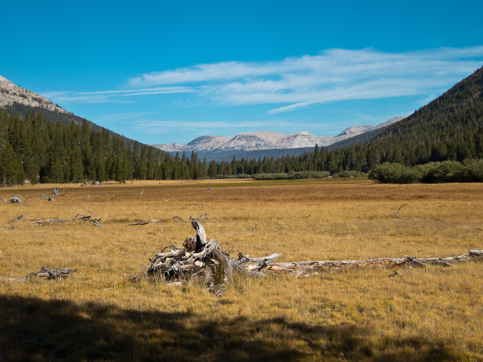
We struck off overland to intersect the JMT a couple miles north. It was both strange and comforting to be back on that highway. We climbed up to Donohue Pass, greeting the throngs of southbound JMT travelers along the way. When we hiked the JMT in 2010 we didn’t notice that many people on the trail, but that’s because we were all traveling north to south. When you’re swimming upstream, it really becomes clear just how popular this trail is.

We stopped at a tarn on the other side of Donohue Pass above Lyell Canyon and Becky inspected her feet. She discovered a blister had formed on her right pinky toe that encompassed the whole end of her toe and swelled it to half again its normal size. This caused great discomfort in her hiking shoe and we decided to put down camp after another mile of limping down the trail.

We enjoyed our last night on the trail - reading, napping, eating and taking in the last of the high-alpine views. We knew the next day’s return to the car meant much-anticipated clean clothes and cheeseburgers, but we were sad to be leaving the peace and tranquility of the high Sierra.


Tuesday, September 2, 2014

SHR Day 8: Minarets, Ritter & Banner

Day 8: Minarets, Ritter & Banner

We got up in the dark and as the morning light crept into the sky we were serenaded by a coyote from somewhere very near by. Kinda cool. Kinda creepy.

The steep climb up to Nancy Pass was the familiar blend of grassy steps, a dirty scree path and blocky talus with a little bit of bushwhacking thrown in for good measure. The geology of this region was very different from the southern high Sierra and we were presented with talus of a wider variety of shapes and sizes - not as many car-sized boulders, but lots of unstable rocks from microwave to grapefruit to pea size. It required a lot of concentration to navigate, but the colors of the different rocks were amazing and provided good distraction.

On the opposite side of Nancy Pass, we dropped down some steep talus, contoured around several wooded benches and wandered through green meadowlands before climbing up to Minaret Lake. There is a maintained trail that goes from the JMT straight to Minaret Lake and we’d be lying if we said we didn’t kind of wish we’d just opted to take it from the get go. Looking up we could start to see the steep and craggy towers of the Minarets above.

After contouring around the lake you come to an imposing headwall that forms a dam for Cecile Lake above. We climbed up to it and despite all the footprints indicating that it was the correct path, were stumped by how to mount what Roper nonchalantly describes as a short “third class slot”. Without a pack on, the climbing would be fine, but with a pack on it was decidedly more difficult, particularly for those of a shorter stature. As Becky fretted and fumed about being sand-bagged by stupid Steve Roper (Pete still maintains it was really only third class and not all that bad), a group of eight Russian trail angels from Florida (no kidding) with a rope appeared and graciously offered to climb up the 20 foot section and then haul our packs on their rope. They’d backpacked this section many years ago and knew a haul line for their particularly large backpacks would be handy. Becky badly wanted to find a different way around so as to navigate the section independently, but there was no other obvious path so we thanked them profusely and accepted their offer. Had our fellow backpackers not arrived, we would’ve figured something out, either climbing with packs or pulling the perlon guylines from the tent to make a haul line, but accepting the assistance was a nice time-saver.

Soon we were standing at the top, packs in hand, once again thanking the Russians for their generosity. We traversed around Cecile Lake to its outlet and started down what might be the grossest section of route we’d been on. Very steep, very loose, very dirty and with bad runout to a lake below and potentially sloughing cliffs above. We actually wished we had climbing helmets at that point. We descended to Iceberg Lake without incident and stopped at one of the most beautifully positioned lakes we’d seen yet. It was crystal clear with numerous granite formations under the water that you can clearly see and above it tower all of the Minarets. There is also a maintained trail that climbs directly to Iceberg Lake from the JMT and we decided that if we ever do this route again, we’re making a beeline for Iceberg and skipping the nonsense of the previous five hours.

The next four hours had us traversing through a broad, beautiful basin peppered with boulders and streams below Ritter Peak before climbing up gentle benches and slopes to a shoulder above Nydiver Lakes (beautiful lakes!) We took a short break and Becky noted that her feet, ankles and knees were really starting to feel the miles of uneven terrain of the previous week and especially that day. We hadn’t really thought about it until just then, but Pete’s orthotics in his trail-running shoes were basically thick, rigid plastic plates from the balls of his feet back to his heels...no wonder the rocky terrain hadn’t battered his feet as badly as Becky’s.  We fueled up and tackled the last couple of miles to Thousand Island Lake, our final destination of the day.

Before we even set up camp, we threw down our packs and waded into to the thigh-deep, relatively warm lake for a soak. Becky’s feet were on fire with blisters and her knees felt like balloons. This condition prompted us to begin a discussion of what to do next. If we continued on the SHR, we would start another 11 mile, highly convoluted, completely off-trail section the next day before hitting a final 20 miles of trail to get us back to the car. Or we could hightail it over to the JMT, a short two mile hike from where we were and be back to the car in just 20 on-trail miles. Or we could take a zero day at the lake to rest and then proceed with the SHR. This was when we kind of wished we’d brought that extra day of food we left behind at Red’s. Taking a zero day meant eating all of the extra “emergency” food we’d brought so if we had a real emergency later, we’d be hosed. We decided to sleep on it.


Monday, September 1, 2014

SHR Day 7: resupply, Superior Lake

Day 7:  resupply, Superior Lake

We started the day with a four mile hike through forest and an old burned area down to Red’s Meadow Resort where we’d dropped off a box of food and supplies one week earlier. While collecting our cache we discovered the manager of the resort was from West Salem and had a house just a few blocks from where Pete had grown up. Small world!

We sorted food and gear while inhaling potato chips and fruit juice from the general store. Based on our pace from the first 55 miles, we decided that we could complete the next 45 mile section in five days instead of six and we ended up leaving behind quite a bit of food. We would kind of regret that a little bit later on.

Red’s was the lowest elevation we’d been at in a week - 7750 feet and departing that elevation at 11:15am to start our climb up to a lake at 9500 feet meant just one thing - it was going to be hot. And it was. We got back on the JMT for a few more miles before turning east to catch the trail to Superior Lake. This was a an extremely boring, dry, dusty climb through the forest. We were encouraged by thoughts of swimming in what was sure to be a lovely alpine lake if it had been named “Superior”...right? Wrong. It was a green, algae-filled, muddy, grassy-banked pond that had no good entry points for swimming. There was nothing superior about this body of water, but it was water and we needed some so we put down camp for the night.

The next section of the route would go completely off trail and once again we found ourselves staring up at the slope we would have to ascend in the morning thinking “Really?” Looking at the map we knew we had a long way to go the next day so we set the alarm for 5:30am in order to get us on the trail by 6:45am.